
USGS Topographic Mapping: OnDemand Topo Product Expansion
 Introducing the 25K Recreational Topo – A 1:25,000 Scale Map Highlighting Recreational Datasets Available from The National Map
The U.S. Geological Survey’s topoBuilder application allows users to request topographic maps on demand. These maps, known as OnDemand Topos, are available for free and can be tailored to the user’s preferences for location and data content. OnDemand Topos are compiled using the best available data from The National Map.
The topoBuilder application launched in 2022 with the 7.5-Minute Topo. In the following years, the USGS expanded the OnDemand Topos product offerings with the 100K Topo in 2023 and the 25K Recreational Topo and 250K Topo in 2025.
Built with The National Map
The National Map provides the geospatial data that is used for all OnDemand Topo products. Various data products are available from The National Map including structure points, boundaries, elevation (Digital Elevation Models, lidar point clouds, and contours), hydrography, aerial imagery, geographic names, structures, transportation, and landcover tint. Data can be downloaded in variety of formats. Many datasets are compiled through partnerships, whether through federal contracts (e.g., lidar acquisition), state or county collaborations (e.g., trails data through National Digital Trails), or volunteer contributions (e.g., structures collected by The National Map Corps). It’s a nationwide team effort that shares a goal of collecting high-quality accurate data. USGS map products, such as OnDemand Topos, are the culmination of this collaborative effort that highlights the data in a unified cartographic product.
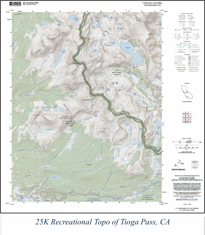
New Layout, New Look: The 25K Recreational Topo
In 2025, the USGS expanded its OnDemand Topo product offerings with a new map product. The 25K Recreational Topo is a 1:25,000-scale topographic map specifically designed to highlight recreational datasets available from The National Map using tailored symbology and labeling.
- Federal land boundaries introduce a modern design that merges historical USGS map boundary symbols with modern styles seen on the 7.5-Minute Topo, creating clear and logical cues to help users determine location.
- National Trails are symbolized with a transparent yellow casing underneath a traditional dash pattern, enhancing visibility without dominating the map.
- Structure symbols have been completely redesigned to improve cohesion and legibility. They are displayed at a larger size to ensure recreational structures are clear and distinct.
https://imiamaps.nextbyte.in/wp-content/uploads/2025/12/Picture1-usgs-dec2.a.pnghttps://imiamaps.nextbyte.in/wp-content/uploads/2025/12/Picture1-usgs-dec2.b.png
These images highlight differences in cartographic design: the 25K Recreational Topo on the left emphasizes recreational datasets such as trails and boundaries, while the 7.5-Minute Topo on the right presents a more traditional topographic representation.
The updated 25K Recreational Topo layout minimizes space around the map, creating a more focused and user-friendly experience. Map collar elements have moved from beneath the map to the right side, reducing negative space and allowing for consistent placement and sizing. Standard USGS topographic map margin elements are present, just in a different location.
A Fresh Look, Same USGS Quality
The updated symbology and map layout give the 25K Recreational Topo a fresh look and feel, while continuing the legacy of trust in USGS topographic maps. The design emphasizes recreational features and other core topographic datasets, which are all available through The National Map, which is in the public domain and can be used freely without restriction.
Users can request 25K Recreational Topos through the topoBuilder application, alongside other OnDemand Topo product offerings.
For questions, support, or feedback on USGS topographic maps, please visit Topographic Maps or contact tnm_help@usgs.gov.