
Exploring the Latest Mapping Innovations
The cartographic industry continues to evolve quickly, with new tools and datasets shaping how mapmakers work at the start of 2026. From photorealistic 3D basemaps and globally consistent datasets to a new publication that makes core principles more accessible than ever, these developments help map publishers and cartographers produce modern, accurate, and visually compelling maps while streamlining workflows.
Seeing the World in 3D
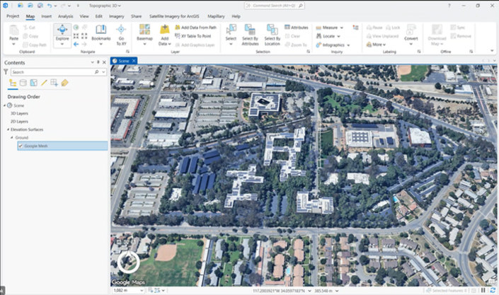 Esri and Google have partnered to bring high-quality photorealistic 3D basemaps into the ArcGIS Platform, making thousands of cities worldwide available to explore in a realistic view. With this new 3D capability, mapmakers can:
- Realistically represent buildings, terrain, and urban landscapes
- Enhance storytelling and workflows
- Reduce the need for custom-generated 3D content
This 3D basemap is currently in beta—join the program to test the tool, provide feedback and help shape its development.
Expanding Basemap Options with Overture Maps
Access to high-quality, reliable data is foundational. ArcGIS is expanding its basemap options with Open Basemap styles built with Overture Maps data. Overture focuses on creating interoperable, open map datasets that support collaboration and innovation.
By incorporating Overture data, ArcGIS delivers globally consistent basemap styles built from open data that are updated on a regular basis. This gives mapmakers standard, high-quality foundational layers for use across projects, with easy exploration through Overture Maps Explorer and seamless use across ArcGIS apps, tools, and workflows.
To review the full list of style offerings available, please visit the Open Basemap styles on the ArcGIS Basemap Styles website.
Designing Maps That Communicate
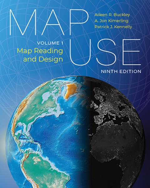 Alongside new tools and datasets, Map Use: Map Reading and Design, Volume 1, published on March 3, explores how maps are read and understood, making basic cartographic principles more accessible.
For map publishers, cartographers, and designers working across print and digital formats, the book provides guidance on effective map design and interpretation—helping ensure that modern maps remain clear and purposeful. If you’re interested in exploring these principles further, learn more here.
Why This Matters
These developments highlight meaningful opportunities for mapmakers to modernize workflows while strengthening their map quality and consistency. We encourage you to explore these new tools, engage with the latest ArcGIS open data integrations, and stay informed on resources that support both innovation and best practices in map design.