
Celebrating 100 Years of the Appalachian Trail
New Overview and Planning Map
New Editions of Appalachian Trail Topographic Map Guides
In 2025, the Appalachian Trail (commonly referred to as the A.T.) marked its Centennial, celebrating 100 years of conservation, community and history. First envisioned by Benton MacKaye in 1921 and completed in 1937, this iconic hiking trail spans over 2,190 miles from Springer Mountain in Georgia to Mount Katahdin in Maine. The trail embodies a profound appreciation for wilderness and a connection to nature.

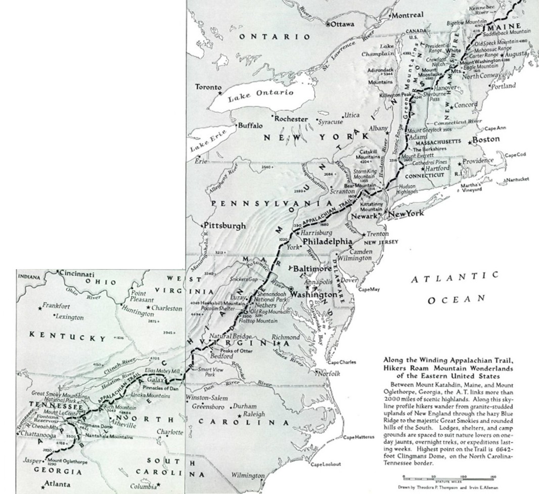
National Geographic’s first article on the Appalachian Trail was published in August of 1949, one year after the first documented thru-hike of the entire trail. Titled “Skyline Trail from Maine to Georgia,” this 34-page article was one of the earliest profiles of the Appalachian Trail and included National Geographic’s initial map of the A.T.

At the time, the idea of a continuous hiking trail stretching across 14 states was nothing short of audacious. But that early story captivated readers and played a key role in introducing the Appalachian Trail to a broader audience.
In 2013, National Geographic released a reference wall map showcasing the Appalachian Trail. Only two years later, in 2015, National Geographic launched a comprehensive Topographic Map Guide series for the A.T., providing trail-level detail (1:63,360), elevation profiles, shelter locations, along with several other key points of interest for the entire Appalachian Trail. This thirteen-map set quickly became a trusted resource for hikers of all experience levels.
This October, in honor of the trail’s 100th anniversary, National Geographic is proud to release the new Appalachian Trail Overview and Planning Map along with complete updates to the thirteen A.T. Topographic Map Guides and the A.T. reference wall map.
Here’s to the next hundred years.